Global Earth Relief Grids
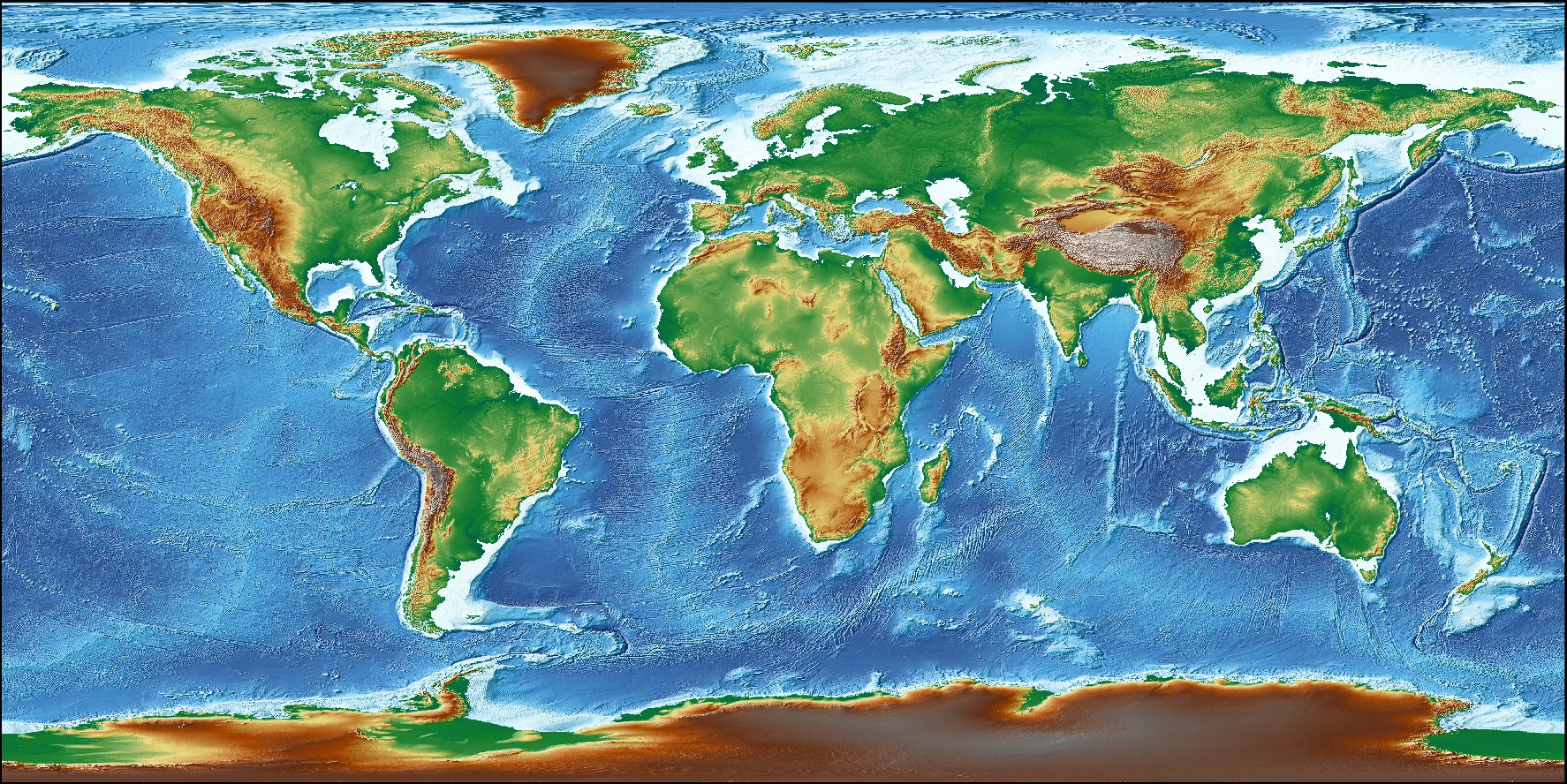
In addition to the GSHHS coastlines, rivers, and borders data built into some modules (coast, gmtselect, grdlandmask), we offer several remote global data grids that you can access via our remote file mechanism. The first time you access one of these files we will download the file from the GMT server and save it to the server directory under your GMT user directory (~/.gmt). We then read the file from there. Should you have limited space then there are ways to control how much is downloaded (see below).
Usage
We have processed and reformatted publicly available global relief grids and standardized their file names. In GMT, you may access a global relief grid (or a subset only by using the -R option) by specifying the special name
@earth_relief_rru
where rr is a 2-digit integer specifying the grid resolution in the unit u, where u is either d, m or s for arc degree, arc minute or arc second, respectively. The following codes for rru are supported:
Code Dimensions Size Description 01d 361 x 181 106 KB 1 arc degree global relief (SRTM15+V2 @ 111 km) 30m 721 x 361 363 KB 30 arc minute global relief (SRTM15+V2 @ 55 km) 20m 1081 x 541 759 KB 20 arc minute global relief (SRTM15+V2 @ 37 km) 15m 1441 x 721 1.3 MB 15 arc minute global relief (SRTM15+V2 @ 28 km) 10m 2161 x 1081 2.8 MB 10 arc minute global relief (SRTM15+V2 @ 18 km) 06m 3601 x 1801 7.3 MB 6 arc minute global relief (SRTM15+V2 @ 10 km) 05m 4321 x 2161 10 MB 5 arc minute global relief (SRTM15+V2 @ 9 km) 04m 5401 x 2701 16 MB 4 arc minute global relief (SRTM15+V2 @ 7.5 km) 03m 7201 x 3601 27 MB 3 arc minute global relief (SRTM15+V2 @ 5.6 km) 02m 10801 x 5401 58 MB 2 arc minute global relief (SRTM15+V2 @ 3.7 km) 01m 21601 x 10801 214 MB 1 arc minute global relief (SRTM15+V2 @ 1.9 km) 30s 43201 x 21601 765 MB 30 arc second global relief (SRTM15+V2 @ 0.9 km) 15s 86400 x 43200 2.6 GB 15 arc second global relief (SRTM15+V2) 03s 432001 x 216001 6.8 GB 3 arc second global relief (SRTM3S) 01s 1296001 x 432001 41 GB 1 arc second global relief (SRTM1S)
All of these data will, when downloaded, be placed in your ~/.gmt/server directory, with the SRTM data organized in sub-directories srtm1 and srtm3 within the server directory.
Technical Information
As you see, the 30s and lower resolutions are all derivatives of Scripps’ SRTM15+V2 grid (Tozer et al., 2019). We have downsampled it via Cartesian Gaussian filtering to prevent aliasing while preserving the latitude-dependent resolution in the original 15 arc sec grid. The full (6 sigma) filter-widths are indicated in parenthesis. The 3 and 1 arc second data are the SRTM 1x1 degree tiles from NASA. When the 15s or lower resolution grids are accessed the first time we download the entire file, regardless of your selected region (-R). However, for the SRTM tiles we only download the tiles that are inside your selected region the first time they are referenced. Also note that the 3 and 1 arc second grids only extend to latitudes ±60˚. The SRTM tiles are only valid over land. However, when these grids are accessed as @earth_relief_01s or @earth_relief_03s we will automatically upsample the @earth_relief_15s grid to fill in the missing ocean values (but only if the region includes oceanic areas). If you just want the original land-only SRTM tiles you may use @srtm_relief_03s or @srtm_relief_01s instead. All grids are gridline-registered except the original SRTM15+V2, here called @earth_relief_15s.
The dimensions above reflect the number of nodes covered by the global grids and the sizes are the file sizes of the netCDF-4 compressed short int grids, making the files much smaller than their original source files without any loss of precision. To improve download speed, the SRTM tiles are stored as JPEG2000 images on the GMT server due to superior compression, but once downloaded to your server directory they are converted to short int compressed netCDF4 grids for easier access. This step uses our GDAL bridge and thus requires that you have built GMT with GDAL support and that your GDAL distribution was built with openjpeg support.
Data Space Concerns
There are several ways you can control the amount of space taken up by your own server directory:
- You can set an upper file size limit for download via the GMT default setting GMT_DATA_SERVER_LIMIT; the default is unlimited.
- You can remove the entire server directory via gmt clear data.
- You can be clever and set up a crontab job that deletes data files you have not touched in, say, 6 months (or some other interval).