(44) Map insets
In this example show how inset can be used to place map insets on top of your map. The map inset is usually intended for placing a smaller-scale version of the larger geographical context of your main plot, so that reader unfamiliar with the detailed map can see what region we are looking at. The inset module automatically determines the possible extent of the map hence we simply pass ? for the unknown map sizes.
#!/usr/bin/env bash
#               GMT EXAMPLE 44
#
# Purpose:      Illustrate use of map insets
# GMT modules:  coast, basemap, mapproject
#

gmt begin ex44
	gmt subplot begin 2x1 -Fs6i/4i -B -BWSne
		gmt coast -R10W/5E/35N/44N -JM6i -EES+gbisque -Gbrown -Wfaint -N1/1p -Sazure1 -Df --FORMAT_GEO_MAP=dddF -c0
		gmt inset begin -DjTR+w2i/0.93i+o0.15i/0.1i -F+gwhite+p1p+c0.1c+s
			gmt coast -R15W/35E/30N/48N -JM? -Da -Gbrown -B0 -EES+gbisque --MAP_FRAME_TYPE=plain
		gmt inset end

		gmt coast -R110E/170E/44S/9S -JM6i -Wfaint -N2/1p -EAU+gbisque -Gbrown -Sazure1 -Da --FORMAT_GEO_MAP=dddF -c1
		gmt inset begin -DjTR+w1.5i+o0.15i/0.1i -F+gwhite+p1p+c0.1c+s
			gmt coast -Rg -JG120/30S/? -Da -Gbrown -A5000 -Bg -Wfaint -EAU+gbisque
		gmt inset end
	gmt subplot end
gmt end show
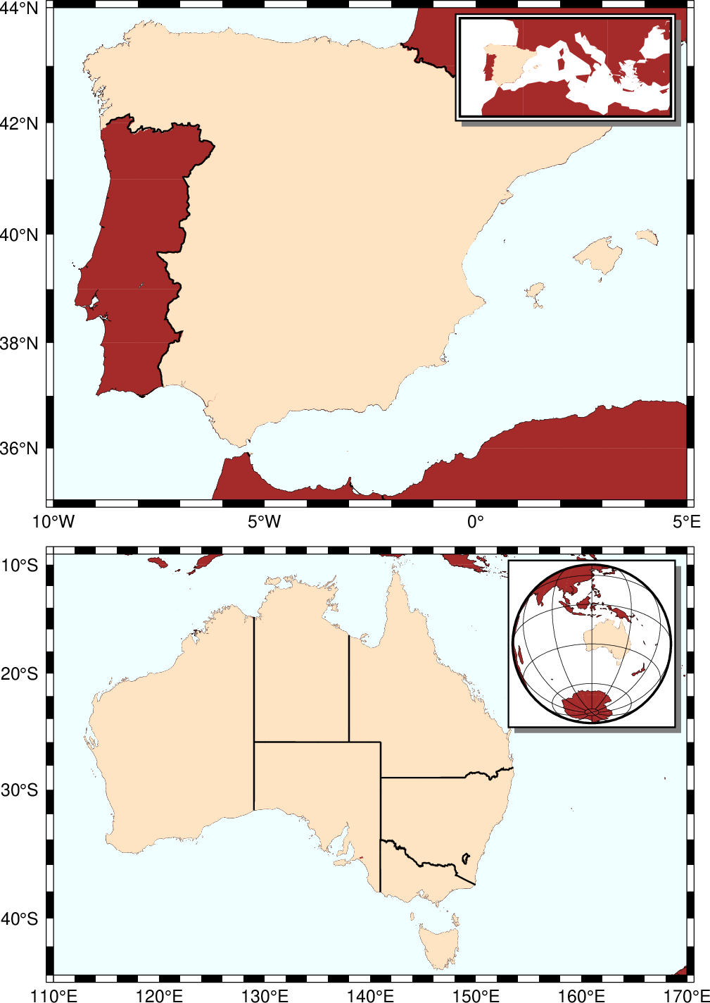
Map Insets.