(35) Spherical triangulation and distance calculations
The script produces the plot in Figure. Here we demonstrate how sphtriangulate and sphdistance are used to compute the Delauney and Voronoi information on a sphere, using a decimated GSHHG crude coastline. We show a color image of the distances, highlighted with 500-km contours, and overlay the Voronoi polygons in green. Finally, the continents are placed on top.
#!/bin/bash
#               GMT EXAMPLE 35
#               $Id$
#
# Purpose:      Illustrate sphtriangulate and sphdistance with GSHHG crude data
# GMT modules:  pscoast, psxy, makecpt, grdimage, grdcontour, sphtriangulate, sphdistance
# Unix progs:   rm
#
ps=example_35.ps

# Get the crude GSHHS data, select GMT format, and decimate to ~20%:
# gshhs $GMTHOME/src/coast/gshhs/gshhs_c.b | $AWK '{if ($1 == ">" || NR%5 == 0) print $0}' > gshhs_c.txt
# Get Voronoi polygons
gmt sphtriangulate gshhs_c.txt -Qv -D > tt.pol
# Compute distances in km
gmt sphdistance -Rg -I1 -Qtt.pol -Gtt.nc -Lk
gmt makecpt -Chot -T0/3500 > t.cpt
# Make a basic image plot and overlay contours, Voronoi polygons and coastlines
gmt grdimage tt.nc -JG-140/30/7i -P -K -Ct.cpt -X0.75i -Y2i > $ps
gmt grdcontour tt.nc -J -O -K -C500 -A1000+f10p,Helvetica,white -L500 -GL0/90/203/-10,175/60/170/-30,-50/30/220/-5 -Wa0.75p,white -Wc0.25p,white >> $ps
gmt psxy -R -J -O -K tt.pol -W0.25p,green,. >> $ps
gmt pscoast -R -J -O -W1p -Gsteelblue -A0/1/1 -B30g30 -B+t"Distances from GSHHG crude coastlines" >> $ps
# cleanup
rm -f gmt.conf tt.pol tt.nc t.cpt
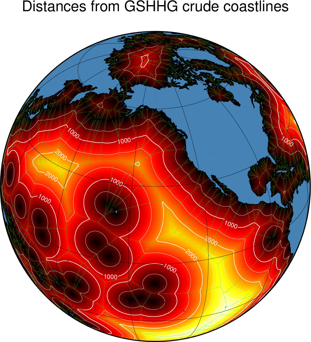
Spherical triangulation and distance calculations