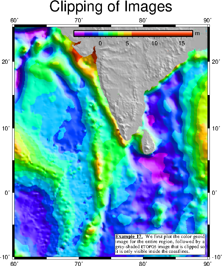
 Example 17. It is often difficult to blend two different gridded
data sets on one map. A solution is to use coastline clipping.
Here, a geoid grid is imaged in color, before pscoast is used to
initiate clipping, followed by a gray-shaded topography. Note that
both images fill the entire map, but the coastline clipping only
lets the images show where we want them to be valid.
Example 17. It is often difficult to blend two different gridded
data sets on one map. A solution is to use coastline clipping.
Here, a geoid grid is imaged in color, before pscoast is used to
initiate clipping, followed by a gray-shaded topography. Note that
both images fill the entire map, but the coastline clipping only
lets the images show where we want them to be valid.
 View GMT script.
 Download zipped PostScript file.
 Back
Back